Monday, August 9, 2010

@ MIT


MIT is an unusual campus in that architectural qualities each define a series of courtyards in such a way that they evoke a total sense of historical interpretation as you experience them. Within the Kresge courtyard curvilinear forms define negative space as an informal one where pathways and orientation greatly differ from the symmetrical aesthetic of neoclassicism.

Saarinens buildings are heavy and ever so lightly touch the ground, almost appearing to be inflatable. It is appropriate that these are the buildings within the Kresge courtyard where reinterpretation gives students a wholly different environment.


Tuesday, July 20, 2010

Riverway (semester final)


A component of Olmsted's famed Emerald Necklace, the Riverway occupies a snaky subterranean parcel outside of Boston's Fenway neighborhood between the Back Bay Fens and Olmsted Park. Developed in 1890 for the civil purposes of resolving sewage and groundwater, the park is home to a thoroughly layered design of vegetation and pathways.

Below is a series of images which follow the experience of the Riverway as it begins near Wheelock College and moves West into Jamaica Plain.


The Landmark Ctr. marks a major convergence node for area roads, the Riverway tapers to a point towards this zone. Looking the other way the park recedes and diverges into itself.


The transition from urban area to park space starts with the divergence of the topography and continues with the introduction of flora. Tertiary elements enter contextual circumstances as vegetative scale is increased acting as an additional mechanism to isolate patrons from hardscape.


Again we see the use of a veil and we're able to sense the familiar city somewhere through and above us..


Coming from Fenway our experience begins as a single pathway sinking and curving into the wood, only the Muddy River at the long northern bank. Just as the vegetation changes scale so does the perception of space discovered by the meanderer.


If we can pretend that within our context floral qualities can become a semi-solid layer, as the Riverway unfolds the sequential properties become tiers which multiply; solid, void, solid, void and so on.


The Muddy River acts as groundwater resolution for neighborhoods in the north and south. Once again, ideas transform into realizations that are multi faceted.


A connection to public transportation along the north side just over the berm adds not only convenience to local residents but more so provides these people with a soft zone to enter and exit into before and after their commutes.


Intermittent connections cross overhead and allow walkers, runners, bicyclists, or wanderers the opportunity to diverge into the space. They also act as stimuli reminding us that we're not in the middle of nature, but within a pocket of contained nature.


Framed views give bridging dual purpose; serving both a civic function and an artistic one.


State Street (walk 5)


The Old State House is something resembling the museum piece surrounded by the glass of subsequent architecture. What becomes immediately palpable is the scale of the building among the hustle and bustle of the city, isolating it as a period piece.

The street is now home to offices, banks, parking, convenience stores and the like. Contemporary reality is the polarity in which the Old State House thrives against, and its central footing make it one of the most interesting pieces in downtown Boston.


Monday, June 21, 2010

Financial District (walk 4)


The fourth walk evidenced rolling spaces and their culminations on the horizon as they rose and fell. Spaces like Boston Common via Park St. station and the Granary Burial Ground conversely recede into contexts that are anything but flat. As we prefaced our later drawings of City Hall with these gestures, it gave way to the same kind of bevelled forms now appearing in building designs.


Facades pushed outward giving their features a malleability that kept datum with the urban wall while also lending itself to flexible uses at street level. Looking around from Government Center began to reveal commonalities in soft edges, round forms, bulging facades, and curvilinear perimetric profiles that opened themselves to the swath of open space in between. While this open space is literally cobbled by bricks and loses the wavelike feel of the Common and the Granary, the buildings all work to summon these nuances with specific language.


Sunday, June 20, 2010

Riverway (walk 3)


Snaking its way through the Fenway neighborhood and into Jamaica Plain is the Riverway, established in 1890 by F.L. Olmsted and part of Boston's Emerald Necklace park system. Olmsted created the area as a low drainage point to resolve groundwater in nineteenth century Boston.

As the road rises toward J.P., the Riverway's tapered entrance near the Landmark Center begins to drop and recede into a forested pedestrian path. The substrata of the park not only serves a civil purpose as Olmsted had intended but simultaneously isolates the walkers experience and severs the urban connection. Soon you are surrounded by a myriad of trees while the city exists somewhere above you. The canopy along the path reiterates feelings of intimacy as explosive views to city buildings that would otherwise reveal urban context become blurred.

The berm establishes an earthen wall to act as an outdoor room, as it comes to a point around the nexus of the Fenway it seems to point toward the Landmark Center and acts like a conduit that reintroduces patrons to the existence of the city.


Thursday, June 10, 2010

Back Bay (walk 2)


Boston's Back Bay is a manufactured installation set in place by the marking of the old Mill Dam. Land taken from Beacon Hill and Needham was used to fill the Charles River and develop the neighborhoods we currently experience between Beacon and Boylston Streets. These streets run east/ west and are parallel to Commonwealth and Marlborough, which also mark the neighborhood.


A series of north/ south streets is alphabetized to provide navigation-friendly datum; Arlington, Berkeley, Clarendon, Dartmouth, Exeter, Fairfield, Gloucester, and Hereford. As you move west, you traverse the alphabet.

We paid close attention to a corner condition at the intersection of Berkeley and Commonwealth, building elements seemed designed to frame the experience to the city:


The facade of the residence on the east side of Commonwealth noticeable broke with the language of the urban wall it was a part of by stepping down a full story. A corner turret delineated a perceived language that a rotational transition was imminent and forthcoming, and just as you reach the edge of the house you realize the entrance flanks the west end and is set back which pulls your gaze through the corner and into city fabric.

On the other side of the street an apartment building acts as a sort of rudder, which adds indelibly an emboldened desire to direct all attention through this very specific corner. It is proportioned so that horizontal reveals all point toward context on the horizon, taller and longer than its width, it exerts pictorial gravity.

Later on we drew neighborhood churches, each from a different period. Two in particular were examined; First Lutheran on Berkeley St and First Church of Boston on the corner of Marlborough and Berkeley. Both churches had designed elements that directly effected subjects by demarcating outdoor spaces with an air of sanctity; First Lutheran with its courtyard and First Church with some sort of urban den which sinks a few feet below grade before rising to the church entrance:


Our final stop was Copley where we drew Trinity Church. Proportions were so well considered that seams between building materials always brought the eye to some geometric whole. It was pleasant to be within the portico among carefully considered columns while looking out onto the square where the trees felt like they were a correlation to the slender vertical elements at hand.


Monday, May 31, 2010

beacon hill walk (walk 1)


Following Seasholes text, we were required to generate impressions of Boston's Beacon Hill; currently home to high rents where vestiges of Nineteenth century Brahmin society are evident in regal masonry facades.

History tells us that everything east of Charles St. is infill land taken from the original Tri-Mountain area of which only Beacon remains. Brimmer and River Streets run parallel to Charles Street and all terminate at Beacon Street where views through the Common lead toward downtown. These streets are a canvas of period pieces that seemed to be veiled from the contemporary era by the use of park space in the Common.

Hierarchy within the city fabric is crucial for air and light, Primary streets like Beacon affront cross streets like Charles. Alleys (think Beaver Place) act as tertiary passages which allow daylight into buildings and provide good ventilation outlets.

The Charles Street Meeting House is pictured above, the carve-out establishes this corner as a dynamic node. Beyond the seating area are views to River Street.


Walking down Beaver Place toward the Fiedler footbridge and the Esplanade. This passageway enables pedestrian access to connect with the park space along the Charles River. As we approach Storrow Drive we are able to utilize the footbridge that provides continuous connection with the Esplanade. Although the Fiedler bridge gets points for creating this momentary connection, it is arguably still only a precedent for another kind of convalescence that could yield panoramic connection as the recently built Rose Kennedy Greenway is struggling to create.


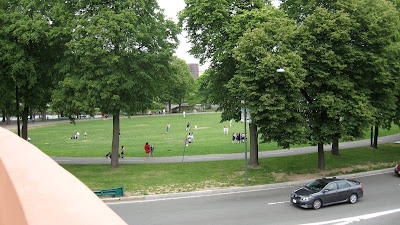
Once on the Fiedler bridge we pass over Storrow Drive and are able to walk continuously without the added disturbance of waiting for traffic lights. Beyond, people use the park space for a variety of activities; the Hatch Shell is not far and ubiquitous sailors and rowers pepper the river in a good display of how our city is perpetually used.


The drawing reiterates the concept of a veiled neighborhood behind the park space of the Common, which seems to serve as a mechanism to cleanse the palette as we traverse from one district to the next. In this case, the transition area started at Park Street station in the midst of skyscrapers and high-rises before sauntering through the park toward Beacon Hill.


Importance is highlighted furthermore by the availability of the neighborhood to use the Common area and Esplanade. Different groups can feel the presence of breathing room during a typical days course; a resident walking to work can feel the diversity of varied spaces without the stuffy reality of feeling like they're living too close to their job.


The scale also seems to explode as we walk from Beacon Hill toward downtown. Within the neighborhood there's a visual perception of compression as continuous townhouses squish their faces together and seem to emphasize their vertical projection. The streets and sidewalks are small enough that walking two by two isn't easy, and then all at once we reach Beacon Street and the Park and everything opens up to reveal space and change and perceivable rescaling.